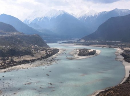
Beijing: Melting glaciers and barrier lakes could threaten China’s plan to build the world’s biggest hydroelectric dam over the Brahmaputra River in Tibet close to the Arunachal Pradesh border, a media report said Wednesday.
The proposed dam which one Chinese official said has “no parallel in history” will be built in Medog county, where the Brahmaputra Grand Canyon is located. Medog is the last county in Tibet which is located close to the Arunachal Pradesh border.
The plan to build the mega-dam, which is part of China’s 14th five-year plan beginning from this year, was approved by China’s Parliament, the National People’s Congress in March this year.
But the engineers are concerned about the threats posed by landslides and barrier lakes to the dam, the Hong Kong-based South China Morning Post reported.
“But an icy obstacle could put a halt to much of the plan. In 2018, a landslide caused by a melting glacier blocked the Yarlung Tsangpo – the upper stream of the Brahmaputra River – at the Sedongpu Basin in Milin county,” it said.
It formed a lake containing about 600 million cubic metres of water. With the river spilling over the top at present, the dam could collapse at any time, it said.
The Sedongpu lake sits just a few dozen kilometres upstream from the planned construction site of the super hydropower plant. With so much water hanging overhead, no construction workers can move in to clear the ground, it said.
To build the big dam, they must get rid of the small dam formed by the landslide first, the report said.
India and Bangladesh, the lower riparian states, have raised concerns over China’s plan to build the massive dam on Brahmaputra River. But China has downplayed such anxieties saying it would keep their interests in mind.
As a lower riparian state with considerable established user rights to the waters of the trans-border rivers, the Indian government has consistently conveyed its views and concerns to the Chinese authorities and has urged them to ensure that the interests of downstream states are not harmed by any activities in upstream areas.
Brahmaputra river is known as Yarlung Zangbo in Tibet.
The Brahmaputra is the longest river in Tibet and its valley in southern Tibet is the world’s deepest with a 7,000-metre (23,000-foot) drop from the highest mountain peak to the lowest basin.
China plans to build a hydropower plant in the valley with electricity generation capacity reaching 70 gigawatts, about three times that of the Three Gorges Dam, currently the world’s largest built by the country, the report said.
Several teams of scientists and engineers have flown to Sedongpu in recent years, including some of the nation’s top experts in civil engineering, glacier study and landslide prevention. They collected a large amount of data on the site using drones and other advanced equipment and were asked by authorities to come up with a solution after finishing their assessment, it said.
“The situation is very difficult. There is not an immediate solution yet,” Xing Aiguo, a professor of civil engineering at the Shanghai Jiao Tong University who was involved in one of the studies told the Post.
The experts could not find a way to strengthen the landslide dam or remove it safely. Worse still, they found similar disasters would likely happen again in the same area, thanks to climate change.
“The area is large and there are many glaciers,” Xing said. Even if there is a method, treating such a harsh natural landscape with engineering methods could be technically challenging and costly, he said.
A quarter of the glaciers on the Tibetan Plateau have disappeared since the 1970s, and two-thirds of the remaining will be gone by the end of the century, the Post report quoted an estimate by the UN’s Intergovernmental Panel on Climate Change.
Studies have found that increased meltwater and rising temperatures could make the “roof of the world” more habitable with greater crop yields and advancing tree lines, but the risk of natural disasters, including flooding and landslides, also increased.
And ice could turn a landslide into something more destructive. At Sedongpu, for instance, the icy debris travelled more than 10km with a top speed of 72km/h according to an estimate by Tibet autonomous region’s geological environmental monitoring station.
The icy material also loosened the landslide dam and made it more prone to collapse. The sheer drop in elevation means even a relatively small amount of water could cause serious destruction downstream, it said.
Liu Chuanzheng, a government researcher with the Consultative Centre of Geohazard Mitigation under the Ministry of Natural Resources in Beijing, said human activity in the Sedongpu area “should be avoided altogether”.
“The development and utilisation of natural resources and energy in the Yarlung Tsangpo river must fully consider the situation of avalanches and debris flows in the Sedongpu valley,” he said in an official report about the landslide published in the journal Geology in China in 2019.
Some Chinese scientists have proposed that instead of building a super dam, a 16km-long tunnel could be dug through one of the high mountains in the Yarlung Tsangpo valley.
The water could be directed into the tunnel to push electricity-generating turbines. This scheme would reduce the power output to 50GW – or about twice that of the Three Gorges Dam – but reduce the risk of damage from landslides or other natural disasters.
PTI


