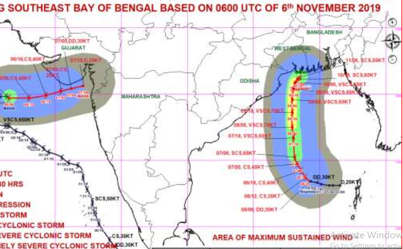
Bhubaneswar: The depression over Bay of Bengal and Andaman Sea that intensified into a deep depression Wednesday remains stationary over east-central and adjoining southeast Bay of Bengal about 810 kilometres south-southeast of Paradip (Odisha), 920 kilometres south-southeast of Sagar Islands (West Bengal) and 960 kilometres south-southwest of Khepupara (Bangladesh), the Wednesday afternoon bulletin of IMD said.
IMD also clarified on the possible direction of Bulbul and said, “It is very likely to move northwestwards for some time and then north-northwestwards towards West Bengal and Bangladesh coasts.”
Bulbul is very likely to intensify into a ‘cyclonic storm’ during next 24 hours and into a ‘severe cyclonic storm’ during the subsequent 24 hours.
“It will be rough to very rough over north Bay of Bengal during November 8 and 9 and very high to phenomenal November 10,” the IMD said.
Fishermen have been advised not to venture into the sea along and off Odisha-West Bengal coasts from November 8 onwards. Those already at sea have been asked to return to shore by November 7 night.
Odisha government, meanwhile, is leaving nothing to chances.
“We have put 15 of the state’s 30 districts on alert in view of the possible heavy rain,” Special Relief Commissioner (SRC) and Secretary, Revenue and Disaster Management, P K Jena said.
The districts which were put on alert are: Balasore, Bhadrak, Kendrapara, Jagatsinghpur, Ganjam, Puri, Gajapati, Koraput, Rayagada, Nabarangpur, Kalahandi, Kandhamal, Boudh, Nuapada and Malkangiri.

