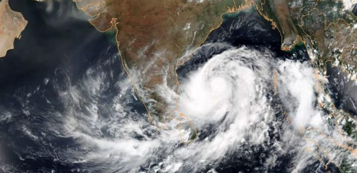
Bhubaneswar: The India Meteorological Department (IMD) Saturday informed that a low pressure area has formed over east-central Bay of Bengal and adjoining north Andaman Sea Saturday and it will intensify into a cyclonic storm by May 24.
“A Low pressure area has formed over east-central Bay of Bengal today the 22nd May 2021 morning (08:30 hrs IST). It is very likely to concentrate into a Depression over east-central Bay of Bengal by tomorrow, the 23rd May morning. It is very likely move north-northwestwards, intensify into a Cyclonic Storm by 24th May and further into a Very Severe Cyclonic Storm during the subsequent 24 hours,” the IMD’s midday bulletin informed.
The weathermen calculated that it would continue to move north-northwestwards, intensify further and reach North Bay of Bengal near West Bengal and adjoining north Odisha & Bangladesh coasts around May 26 morning.
It is very likely to cross West Bengal and adjoining north Odisha & Bangladesh coasts around May 26 evening.
Rainfall warning:
The IMD has issued yellow warning (be updated) to Balasore, Bhadrak, Jajpur, Kendrapada, Jagatsinghpur, Cuttack, Puri, Khurda and Mayurbhanj for 24 hours starting May 25 morning (8:30 am). During these 24hours, very to very heavy rainfall is likely to occur at isolated places of the above mentioned districts.
Similarly, orange warning (be prepared) has been sounded for Balasore, Bhadrak, Jajpur, Kendrapada, Jagatsinghpur, Cuttack, Mayurbhanj and Keonjhar with isolated extremely heavy fall over Mayurbhanj and Balasore for 24 hours starting May 26 morning (8:30 am).
At the same time, yellow warning (be updated) has been sounded for Dhenkanal, Angul, Deogarh and Sundargarh between May 26 and May 27. Isolated places of these districts are very likely to experience heavy rainfall.
Wind warning:
Squally wind speed reaching 40-50 km/h gusting 60 km/h is very likely to prevail over North Bay of Bengal and along and off Odisha coast from May 24 evening. It would increase gradually becoming 50-60 km/h gusting to 70 km/h from May 25 evening. It would further increase becoming gale wind speed 60-70 km/h gusting to 80 km/h from the early hours of May 26 along and off West Bengal & adjoining north Odisha coast. It would gradually increase further becoming 90-100 km/h gusting to 110 km/h from May 26 forenoon and increase thereafter till May 26 evening.
The weathermen forecast that sea conditions will be rough to very rough over Andaman Sea & adjoining east-central Bay of Bengal May 22 and 23. And the sea conditions will be high to very high over major parts of central Bay of Bengal, North Bay of Bengal and along & off Odisha– West Bengal coast during May 24-26.
The fishermen have been warned against venturing into deep sea area of North Bay of Bengal along and off Odisha coast from May 24 to 27. Similarly, fishermen, those are out in the deep sea are advised to return to the coast by May 23.
PNN
