THE PHENOMENON
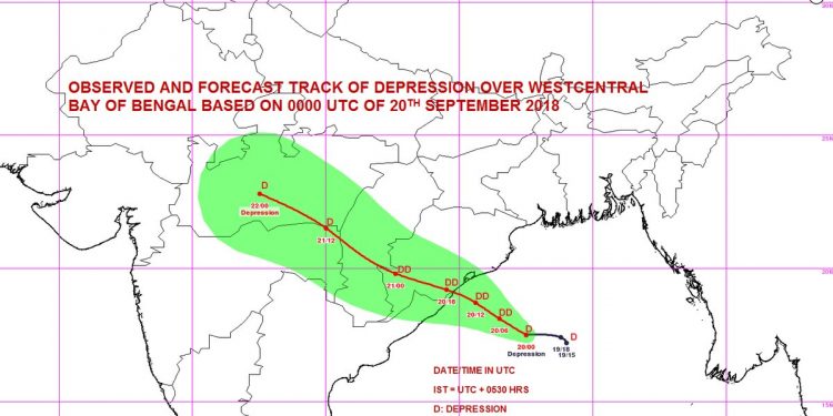
- A deep depression over west-central Bay of Bengal moved west-northwest towards the coast of Odisha and Andhra Pradesh and showed signs of intensifying into a cyclonic storm.
- The depression centered about 400 km of east-southeast of Puri according to last available satellite imagery
- Depression expected to move west-northwest and concentrate into a deep depression and cross Odisha through the night intervening September 20 and 21.
THE EFFECT
- The cyclone may cross south Odisha-north Andhra Pradesh coasts between Kalingapatnam and Puri, close to Gopalpur, around midnight with wind speeds of 60-70 kmph gusting to 80 kmph.
- Heavy to very heavy rain and thundershower across state to continue from late Thursday through Friday (Met department warning for 72 hours starting Thursday)
- Heavy to very heavy rain likely in parts of: Balasore, Bhadrak, Bolangir, Boudh, Cuttack, Gajapati, Ganjam, Jagatsinghpur, Jajpur, Kalahandi, Kandhamal, Kendrapara, Khurda, Koraput, Puri, Malkangiri, Mayurbhanj, Nabarangpur, Nayagarh, Nuapara, Rayagada and Sonepur districts.
- Winds at speeds of 40-50 kmph and of speeds 30-40 kmph likely to blow over coastal and interior districts of south Odisha respectively September 21
PRECAUTIONS TAKEN
- Met office has issued red, yellow and orange warning for districts
- Fishermen advised against venturing along and off Odisha coasts and the Central Bay and North Bay of Bengal for the next 72 hours
- Local cautionary signal number 3 hoisted at all ports in state.
Suggest A Correction


