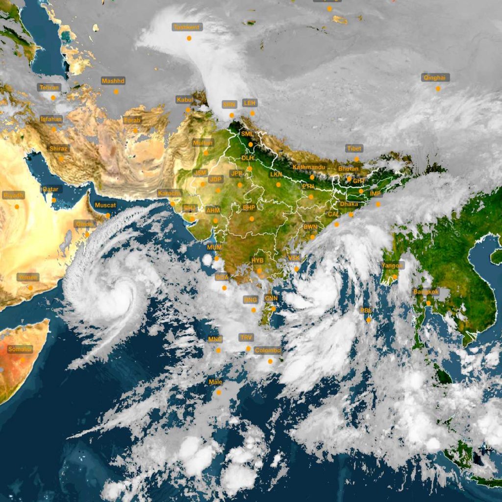
Bhubaneswar: The deep depression formed over the west central Bay of Bengal turned into cyclonic storm ‘Titli’ Tuesday. The storm is likely to intensify further and turn into a severe cyclonic storm by Wednesday morning.
“The cyclonic storm Titli has been formed today. It will intensify and take shape of a severe cyclonic storm. It lay centred at about 530 km southeast of Gopalpur and 480 km east-southeast of Kalingapatnam. It will cross Odisha and north Andhra Pradesh coasts between Gopalpur and Kalingapatnam in the morning of October 11,” IMD’s cyclone warning division head Mrutyunjay Mohapatra told this paper.
All on alert mode
Gusty wind at speed of 100-110 kmph to hit state coast Wednesday morning
Govt asks District Collectors to ensure ‘zero casualty’ during the cyclonic storm
Schools in Puri, Ganjam, Jagatsingpur and Gajpati districts to remain shut
Officers at the district level have been strictly instructed to stay put in headquarters.
The cyclone is likely to cause severe damage in Gajapati, Ganjam, Khurda, Nayagarh and Puri districts. It can damage kutcha houses, power and communication lines, crops, low-lying areas of five districts, the IMD said.
Under its impact, very heavy rainfall is likely to occur in costal and many interior districts of the state till October 12.
Forecasts:
October 10: Very heavy rainfall will occur in Gajapati, Ganjam, Puri, Jagatsinghpur and Kendrapara districts. Khurda, Nayagarh, Cuttack, Jajpur, Dhenkanal, Bhadrak and Balasore districts will also receive heavy rain in next 24 hours.
October 11: Very heavy rain to occur in Gajpati, Ganjam, Puri, Rayagada, Koraput, Kandhamal, Kalahandi, Boudh, Jagatsinghpur, Kendrapara, Khurda, Nayagarh, Cuttack, Jajpur, Dhenkanal, Bhadrak and Balasore districts.
October 12: Balasore. Bhadrak, Keonjhar and Mayurbhanj districts will receive very heavy rain.
The IMD also said squally wind speed reaching 45-55 kmph gusting to 65 kmph is likely to commence along and off Odisha coast from Tuesday night. It is likely to gradually increase to 100-110 kmph gusting to 125 kmph from Wednesday evening onwards in south Odisha coast and 65-75 kmph gusting to 85 kmph along north Odisha coast.
As the sea condition will be very rough, the IMD asked fishermen not to venture into sea till October 12.
Chief Secretary Aditya Prasad Padhi reviewed the preparedness to tackle the situation. He said the Odisha Disaster Rapid Action Force (ODRAF) and National Disaster Response Force (NDRF) personnel have been deployed at various parts of the state. “We have asked coastal districts to evacuate people staying in low-lying areas,” he said.
Special Relief Commissioner (SRC) Bishnupada Sethi directed Collectors to ensure ‘zero causality’. He instructed them to evacuate people residing in low- lying areas and kutcha houses along the coast to safer shelters.
The Collectors are advised to make arrangements for cooked food, safe drinking water, medicine and power supply at these shelters. Livestock will also be shifted to safer places. Authorities were asked to ensure functioning of district emergency operation centres round the clock.
Officers at the district level have been strictly instructed to remain in headquarters and not avail leave during the period. The state is having 879 cyclone-flood shelters across the state. Besides, 300 power boats have been deployed in various districts.
PNN
