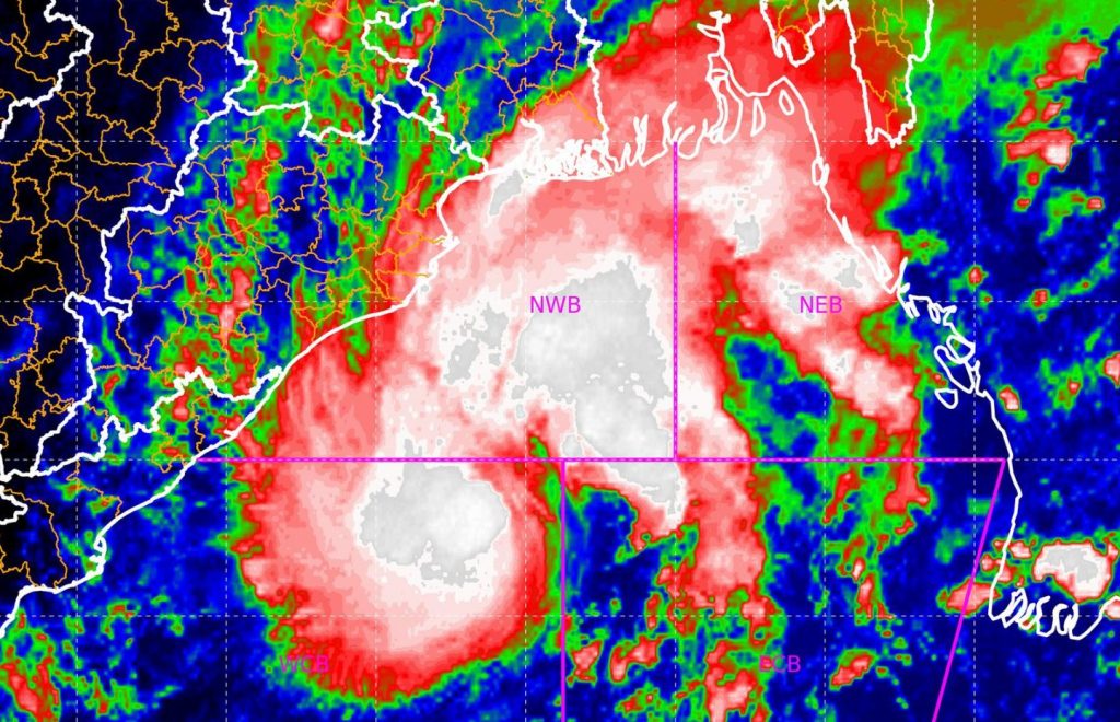
Bhubaneswar: The deep depression formed over the Bay of Bengal may intensify into a cyclone by Monday evening, the India Meteorological Department (IMD) said in a bulletin.
The cyclonic storm, after its formation, will be called ‘Hamoon’, a name given by Iran.
The system is currently located in west-central Bay of Bengal after moving northeastwards Sunday night. It lies centred around 400 km from Odisha’s Paradip and 550 km south-southwest of Digha in West Bengal.
“It is likely to intensify into a cyclonic storm over the next 12 hours. It is very likely to move north-northeastwards and cross the Bangladesh coast between Khepupara and Chittagong around October 25 evening as a deep depression,” the IMD’s morning bulletin said.
Meanwhile, the Odisha government has asked all the district collectors to remain prepared for any eventuality, and directed the administration to evacuate people from low-lying areas in the event of heavy rain.
“The system (cyclone) will move in the sea around 200 km from Odisha coast,” weather scientist US Dash said, adding that under its influence, light to moderate rainfall is likely at a few places in coastal Odisha Monday and at many places over the next two days.
The weather department said that light to moderate rainfall would occur at a few places in northern and southern coastal districts, besides Keonjhar, Mayurbhanj and Dhenkanal.
The fisheries and animal resources development department has advised fishermen not to venture into deep seas.
Keeping in view of the weather conditions, Durga Puja organisers are preparing for possible rain and wind during the festivities.
PTI
