New Delhi: Fairly widespread to widespread rainfall activity is very likely over most parts of east India and adjoining central India from June 10 under the influence of a low-pressure area forming over the north Bay of Bengal and the neighbourhood, the IMD said Monday.
Isolated heavy to very heavy rainfall is also very likely over Odisha, Gangetic West Bengal, Jharkhand, east Madhya Pradesh, Vidarbha and Chhattisgarh during June 8 to June 11, said the India Meteorological Department’s (IMD) National Weather Forecasting Centre in its report.
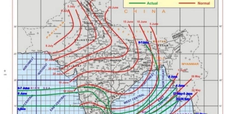
It also said that southwest monsoon is likely to advance into most parts of Odisha, West Bengal and Jharkhand and some parts of Bihar, due to the low pressure area which is likely to form around June 11.
The weather office further predicted enhanced rainfall activity along the west coast.
Due to strengthening of southwesterly winds and other favourable meteorological conditions, the IMD said, fairly widespread to widespread rainfall activity is very likely over northeastern states during the next 4-5 days.
Isolated heavy rainfall was very likely over Arunachal Pradesh, Assam, Meghalaya, sub-Himalayan West Bengal, Sikkim, Nagaland, Manipur, Mizoram, and Tripura from Monday and in the coming days.
Under the influence of the offshore trough at mean sea level from north Maharashtra coast to north Kerala coast, the IMD predicted, isolated to fairly widespread rainfall accompanied with thunderstorm and lightning over parts of south peninsular India during next 4-5 days.
“Dust raising strong surface winds (30-40 kmph) very likely to prevail over plains of northwest India during June 8 and 10.”
IANS


