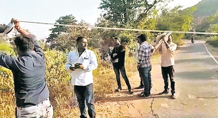
Paralakhemundi: Even as the border dispute between Andhra Pradesh and Odisha in the fringe areas of Gajapati district remains unresolved, the revenue departments of both the states have started joint survey in the areas, a report said.
According to the report, for the last few years, the neighbouring state has been trying to claim parts of bordering areas in Gajapati illegally. The land owned by some farmers in Gajapati is near the borders of Srikakulam district.
Some farmers of S Kabiti village in Srikakulam district have allegedly claimed ownership of the land owned by Gajapati farmers. They have even undertaken farming on the land.
Gajapati farmers have raised their objection in this regard at the district administration.
Paralakhemundi tehsildar Achyutananda Jani had drawn attention of the Collector towards the land issue. The issue was earlier discussed by the Collectors of Gajapati and Srikakulam districts.
Following direction from the Collectors of the neighbouring districts, the Paralakhemundi and Purunapatnam tehsildars and field level revenue officials have started demarcation work with the help of border maps recently. Paralakhemundi tehsildar Achyutananada Jani told reporters that during the land settlement, survey stones have been set up at different fringe areas where the dispute has cropped up.
“These survey stones are being measured and other missing stones are being looked for. It will take two to three days to demarcate the land and the dispute will be resolved,” he added.
The joint survey team comprising Paralakhemudi tehsildar, a RI, an ARI, four amins of Gajapati, Purunapatnam tehsuildar M Kalika Prasad, a circle surveyor, a VRI and four village surveyors is on its toes identifying the borders.
It may be noted here that the disputed land is under Chiridiguda Khasapa mouza under Kashinagar tehsil. People of S Kabati have been forcibly cultivating the land owned by farmers of Chiridiguda Khasapa mouza.
Ten days back, a special settlement team from Berhampur along with local revenue staff of Koraput had conducted a survey to ascertain the Odisha-AP border. The team found that the original boundary marks were intact as per the 1955 settlement survey by Madras Presidency and not “manipulated” as claimed by AP villagers.
However, some encroachment of government land for cultivation was detected from both sides and Koraput Collector was informed to do the needful. The border row has been raging since a month after some AP villagers repositioned a boundary signboard 500 metres into the Odisha side.
Meanwhile, a similar territorial dispute was witnessed in Gajapati district where villagers claimed encroachment by bordering AP villagers and prompted a joint survey on the day.
PNN
