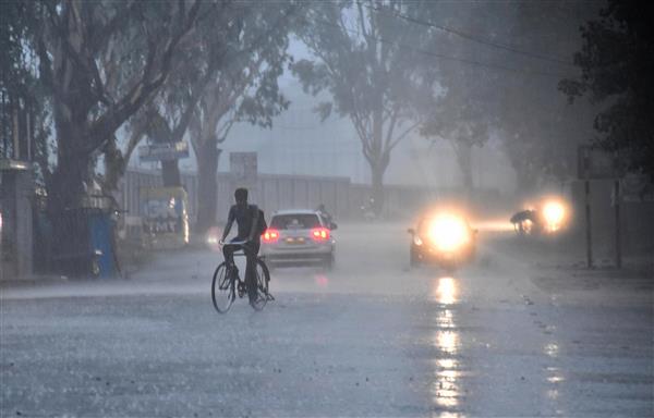
New Delhi/Mumbai: The monsoon Sunday covered both Delhi and Mumbai together for the first time since June 21, 1961, the India Meteorological Department (IMD) said.
While it hit the national capital two days before schedule, its entry into the financial capital is two weeks late, the Met office said.
“It is the first time since June 21, 1961, that the monsoon arrived in Delhi and Mumbai at the same time,” said DS Pai, a senior scientist at the India Meteorological Department (IMD).
The Safdarjung Observatory, Delhi’s primary weather station, logged 48.3 mm rainfall in the 24 hours ending at 8.30 am Sunday.
The Dhansa weather station logged around 80 mm, Jafarpur and Lodi Road around 60 mm each, Ayanagar and Mungeshpur around 50 mm each and SPS Mayur Vihar 40 mm, according to the IMD.
The Met office termed the monsoon activity over Haryana, Chandigarh and Delhi as ‘vigorous’.
According to the IMD, monsoon activity is considered ‘vigorous’ if the recorded rainfall is more than four times the normal or it is fairly widespread or widespread.
In Mumbai, the Colaba Observatory, representative of the island city, recorded 86 mm rainfall in the 24-hour period ending at 8.30 am Sunday while the Santacruz weather station, representative of the suburbs, registered 176.1 mm in the same period, according to the IMD.
“The southwest monsoon has further advanced into the remaining parts of Maharashtra, including Mumbai, Madhya Pradesh, Uttar Pradesh, Delhi, some parts of Gujarat, Rajasthan and Haryana, the remaining parts of Uttarakhand and most parts of Himachal Pradesh and some more parts of Jammu, Kashmir and Ladakh today (June 25),” the IMD said in a statement.
The northern limit of monsoon has now passed through Veraval, Baroda, Udaipur, Narnaul, Ambala and Katra.
Conditions are favourable for further advance of the monsoon into some more parts of Gujarat, Rajasthan, Haryana, Punjab and the remaining parts of Jammu and Kashmir during the next two days, the IMD said in a noon update.
Normally, the monsoon reaches Kerala by June 1, Mumbai by June 11, and the national capital by June 27.
The trajectory that the monsoon followed this year is unusual.
While it covered a significant portion of north India, including Ladakh, Himachal Pradesh, Uttarakhand, and a large part of Jammu and Kashmir, on schedule or slightly ahead, it is running two weeks behind schedule for a considerable part of central India, where a significant number of farmers heavily rely on it.
Pai explained that Cyclone Biparjoy had impacted the monsoon’s progress over southern India and the adjoining western and central parts of the country.
He said, “Since the system absorbed most of the moisture, the monsoon’s progress along the west coast was slow.”
However, the Bay of Bengal branch of the monsoon, responsible for bringing rain to northeast and east India, remained stronger between June 11 and June 23.
Pai attributed this to a low-pressure system that formed over the Bay of Bengal in mid-June and the remnants of Cyclone Biparjoy, which aided the monsoon’s advancement over east India.
Pai noted that the Arabian Sea branch of the monsoon is now gaining strength with a low-pressure system developing over the Bay of Bengal.
He said that it represents a new pulse of the monsoon and added that rapid progress is expected.
According to IMD data, the monsoon reached the national capital June 30 last year, July 13 in 2021, June 25 in 2020, July 5 in 2019 and June 28 in 2018.
It hit Mumbai June 11 last year, June 9 in 2021, June 14 in 2020, and June 25 in 2019.
This year, the monsoon arrived in Kerala on June 8, a week after its usual onset date of June 1. In comparison, it reached the southern state on May 29 last year, June 3 in 2021, June 1 in 2020, June 8 in 2019 and May 29 in 2018.
Research indicates that a delay in the onset of monsoon over Kerala does not necessarily result in a delay in its arrival over northwest India nor does it impact the total rainfall over the country during the season.
The IMD previously stated that India is expected to receive normal rainfall during the southwest monsoon season despite the evolving El Nino conditions.
El Nino, which is the warming of the waters in the Pacific Ocean near South America, is generally associated with the weakening of monsoon winds and dry weather in India.
The IMD’s prediction of ‘normal’ monsoon, however, doesn’t mean that each part of the country will log good rainfall during the season.
It essentially means that the total rainfall will be within the normal limits though there could be excess precipitation at some places and deficient at others.
Northwest India is predicted to experience normal to below-normal rainfall while the east, northeast, central and south peninsula regions are expected to receive normal rainfall at 94-106 per cent of the long-period average.
According to the IMD, rainfall between 96 and 104 per cent of the 50-year average of 87 cm is considered ‘normal’. Rainfall below 90 per cent is categorised as ‘deficient’, between 90 and 95 per cent is ‘below normal’, between 105 and 110 per cent is ‘above normal’ and anything above 100 per cent is classified as ‘excess’ precipitation.
Normal rainfall is critical for India’s agricultural landscape, with 52 percent of the net cultivated area relying on it. Additionally, it plays a crucial role in replenishing reservoirs essential for drinking water and power generation throughout the country.
Rainfed agriculture accounts for approximately 40 per cent of the country’s total food production, making it a vital contributor to India’s food security and economic stability.
PTI
