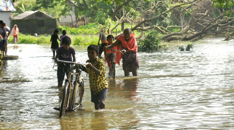
Bhubaneswar: The study— conducted by researchers at the Indian Institute of Technology (IIT) – Bombay and National Remote Sensing Centre, Indian Space Research Organization (ISRO) on the flood risk vulnerability in different parts of Jagatsinghpur district— bats for inclusion of floor risk mapping in policy-making.
The team, based on their study on the flood-prone area of Jagatsinghpur district, tried to analyze the risk factors that the different zones of the district pose to flooding. It also studied the socio-economic ramifications of flooding on the local population.
The team claims that it was a first of its kind study by the researchers which offered a promising way of looking at flood risk through an innovative concept of what is termed as a ‘Risk Classifier’. In their unified multivariate approach in the study, the team batted for the utility of such flood mapping tools in the policies throughout the country.
In their conclusion of the study the six-member researchers’ team said, “The estimation and mapping of flood risk is the primary step towards building a comprehensive flood management strategy for any flood prone region. A flood risk map serves as an essential tool for the general public, disaster experts and civic bodies when adopting various mitigation options through assorted structural (e.g., flood storage reservoirs and dykes) and nonstructural (e.g., flood plain zoning, insurance schemes, and policies) measures”
The team also analysed the socio-economic impact of such disaster on the human population. “Socio-economic vulnerability has its strong roots in flood risk. The impact of floods should not be confined to its technicalities. It is vital to consider various social groups and their dynamic heterogeneity in a population, as they may have different degrees of responses to floods,” said the IDP in Climate Studies, IIT-B Subhankar Karmakar, who is also a professor of Environment Science and Engineering Department.
The researchers claim that the application of the research could be nation-wide. “The proposed framework is generic and can be applied to any flood-prone region. It will be useful especially for low and middle-income nations wherein minimal efforts are invested in the creation of flood-data inventory,” said Subimal Ghosh, Professor, Department of Civil Engineering and IDP in Climate Studies, IIT-B.
“The identification of the source of flood risk is an important catch. It is from here that the government and disaster management bodies can plan to shell out focused flood-management strategies depending on whether the flood-risk is being instigated by hazard or socio-economic vulnerability or both,” said Mohit Mohanty, former PhD research scholar, IIT-B, a member of the study team.
The study identifies the decadal changes in marginal and compound contributions of hazard and socio-economic vulnerability to flood-risk. The state-of-the-art flood inundation model quantifies the hazard at a very fine resolution of 10m × 10m on the ground. On the other hand, the socio-economic vulnerability was measured by considering multiple relevant socio-economic indicators.

