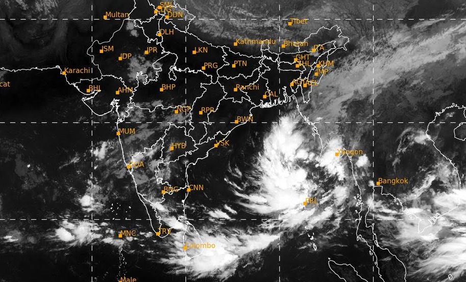
Bhubaneswar: The well-marked low-pressure area over the Bay of Bengal intensified into a depression Tuesday morning as it rolled towards the eastern coast with the likelihood of turning into a severe cyclonic storm, the IMD said.
In its bulletin, the India Meteorological Department (IMD) said that the well-marked low-pressure area over the east-central Bay of Bengal moved west-northwestwards, concentrated into a depression and lay centred at 730 km southeast of Paradip in Odisha around 5.30am.
“It is very likely to move west-northwestwards and intensify into a cyclonic storm by October 23, 2024, over east-central Bay of Bengal,” the bulletin said.
Thereafter, the weather system will continue moving northwestwards and is very likely to intensify into a severe cyclonic storm, which will cross north Odisha and West Bengal coasts between Puri and Sagar Island on the night of October 24 and morning October 25 with a wind speed of 100-110 kmph gusting 120 kmph, it added
READ MORE | Impending cyclone threat: Odisha CM says govt fully prepared, urges people not to panic
The system is likely to affect the coast of both Odisha and West Bengal with heavy rain and high-speed wind, the bulletin said.
Advising fishermen not to venture into the sea from October 23 to 25, the IMD warned that wind speed is likely to reach 60 kilometres per hour (kmph) along and off Odisha-West Bengal coasts and gradually increase thereafter.
The Odisha government sought 10 more additional teams of the National Disaster Response Force (NDRF).
“The existing NDRF teams are already on the move to the possible affected districts,” Revenue and Disaster Management Minister Suresh Pujari said.
This apart, 17 Odisha Disaster Rapid Action Force (ODRAF) teams will be deployed in 10 districts which are likely to be affected by cyclone Dana, Additional Special Relief Commissioner (SRC) Padmanav Behera said.
Three other ODRAF teams will be kept on standby.
Advising fishermen not to venture into the sea from October 23 to 25, the IMD warned that wind speed is likely to reach 60 kilometres per hour (kmph) along and off Odisha-West Bengal coasts and gradually increase after that.
IMD DG Mrutunjay Mohapatra told a local news channel that the entire eastern coast from Puri and West Bengal coast is likely to be impacted in the impending cyclone.
North Odisha districts are also likely to be more affected than other areas, IMD DG said.
Mohapatra said the exact place of landfall of the cyclone would be known later.
The Odisha government has cancelled the leaves of all staff from October 23 to 25 in view of the cyclone forecast.
Special Relief Commissioner DK Singh asked the School and Mass Education department to close schools in 14 likely affected districts from October 23 to 25 as a precautionary measure.
PTI
