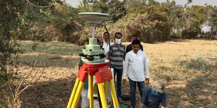
Jaleswar: Revenue officials and scientists of Odisha and West Bengal met at the disputed site of Subarnarekha river here in Balasore district and conducted a measurement of the reference points on the eve of the Tuesday-meeting between the two states on interstate border dispute.
The points of contention between the two states are at Jaleswar in Balasore district and in Dantun area of West Midnapore district of neighbouring West Bengal.
The officials while measuring the reference points also identified the places which have been in contention between the two states. Jaleswar tehsildar Dillip Chand, revenue officials Manas Behera, Gourang Jena and Pradip Bhanja, and five officials of West Bengal were present during the measurement of the reference points.
The development comes after the National Green Tribunal directed the authorities of the two states to resolve the dispute relating to border. Notably, several cases have been filed before the NGT with regard to sand mining and environmental pollution.
Reports said that the dispute began on the jurisdiction of the Subarnarekha river which is flowing for about 10 km on the borders of the two states. Earlier, the officials of two states met at the Circuit House of West Midnapore to resolve the border dispute, February 15. The officials of two states had visited the spot after the meeting and conducted a measurement of South Praharajpur village in the state and Sunakania and other places in West Bengal.
According to decision of Odisha Space Application Centre (ORCAS), 36 reference points have been identified in Odisha border and 52 reference points in West Bengal border with the use of GPS and DGPS systems. Five officials and scientists of West Bengal and three from Odisha rechecked the reference points in Gobarghata, Bilaspur, Makidia and Rajnagar mouzas in Odisha.
PNN

