Nikunja Bihari Sahu
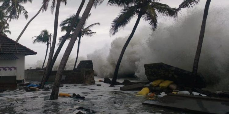
Located at the mouth of the Ganges, where the river empties into the Bay of Bengal, the Sagar island attracts millions of Hindu pilgrims each January for the Ganga Sagar festival. This year, about 2 lakh pilgrims took bath in the sea there on Makar Sankranti. However, the Sagar island, and with it the future of the entire festival, is under increasing threat from rising sea level and coastal erosion.
The Kapil Muni temple, where the pilgrims offer prayers after the holy dip, had to be shifted several times in the past to keep it from being submerged. Sagar Island is part of the Sundarbans, an archipelago of 102 islands, of which 54 are inhabited by more than 4 million people. Some of these islands, such as Bedford, Lohachara, Kabasgadi and Suparibhanga, have already disappeared under the sea. Others such as Ghoramara and Mousuni will soon be lost due to rising sea levels. Due to this, tens of thousands of people have lost their homes and migrated to safer places.
In Odisha, sea level rise is affecting a cluster of seven villages called Satabhaya near Paradip in Kendrapara. Land records in 1930 show the Satabhaya cluster was spread over 320 square kilometres; the 2,000 land records existing at present indicate that the area has shrunk to 155 square kilometres. Five of the seven villages have already been completely swallowed by the sea. The Bay of Bengal is eating through the coast at a brisk pace, taking with it several villages and fertile farmlands in its fold along Ganjam, Puri, Jagatsinghpur and Balasore districts.
India has a 7,500 km coastline spread over nine states, two Union Territories and two island territories — Andaman & Nicobar and Lakshadweep. There are 171 million people, a seventh of India’s population, living in 70 coastal districts in these states, UTs and islands; the majority of them depend on fishing for livelihood. Four of India’s ten most populated cities are on or near the coast, and they are facing an increasing threat of submergence owing to sea level rise.
The picture is not also good for many island nations around the world. Kiribati (Population: 1,07,800) in the Pacific has lost at least two islets already while in the Marshall Islands, home to about 62,000 people, some 60 hectares of dry land (8.6 per cent of the total land area) are in danger of being swallowed.
Closer home, Bangladesh has become highly vulnerable to the sea level rise. About 10 per cent of Bangladesh is hardly 1 metre above the mean sea level and readings taken at Hiron point, Charganga and Cox’s Bazar show a steady rise in sea level. Experts say sea level rise of 1 metre would wipe away almost 60 per cent landmass of India.
Over the past century, the burning of fossil fuels and other human activities have released huge quantities of green-house gases (heat-trapping gases) into the atmosphere. These have caused the Earth’s temperature to rise as oceans absorbed about 80 per cent of the additional heat.
Core samples, tide gauge readings, and most recently, satellite measurements indicate that over the past century, the Global Mean Sea Level (GMSL) has risen by 10 to 20 cm.
The Intergovernmental Panel on Climate Change (IPCC) in 2007 projected a high-end estimate of 60 cm (2 ft) rise in the Mean Sea Level by 2099. This is alarming. Sea-level rise is linked to the thermal expansion of sea water and melting of glaciers owing to global warming.
Hence, climate-induced sea level rise has affected people, places and livelihoods worldwide. Humanity must find an immediate solution to avert this impending disaster. There is an urgent need to retard the rate of global warming on our planet. This can be achieved by cutting green-house gas emissions at individual and collective levels. Phasing out fossil fuels and increasing implementation of green technologies is the need of the hour. Massive plantation drives should be undertaken to ensure greater absorption of carbon dioxide, a major heat-trapping agent.
–The writer is education officer, Regional Science Centre, Bhopal.


