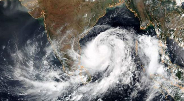
Bhubaneswar: The landfall process of Very Severe Cyclonic Storm (VSCS) ‘Yaas’ still continues. It will take about two hours more to complete, a fresh bulletin issued by India Meteorological Department (IMD) stated Wednesday noon.
The cyclone would cross north Odisha-West Bengal coasts to the south of Balasore within the next two hours as a very severe cyclonic storm with wind speed of 130 to 140 km/h gusting to 155 km/h.
Rainfall forecast –
Light to moderate rainfall at most places with heavy to very heavy rains at a few places with extremely heavy falls at isolated places in Jagatsinghpur, Kendrapara, Jajpur, Bhadrak, Balasore, Mayurbhanj, Cuttack, Dhenkanal, Keonjhar districts and heavy rainfall at isolated places in Puri, Khurda, Angul, Deogarh, Sundargarh on May 26.
Also read: Odisha registers 11,623 new COVID-19 cases; Khurda highest with 2,021
Wind forecast –
Wind speed will remain around 130 to 140km/h gusting to 155km/h along and off Bhadrak and Balasore districts and 100 to 110 km/h gusting to 120km/h along and off Kendrapara district at the time of landfall. However, the wind speed will decrease gradually after landfall becoming 65 to 75km/h gusting to 85km/h by the evening.
Notably, astronomical tides are likely to inundate low-lying areas of Kendrapara and Jagatsinghpur districts around the time of landfall.
The wind speeds reported from different parts of Odisha are: Balasore (87), Chandbali (74), Paradip (33) and Bhubaneswar (33).
PNN


